 Land is a precious resource because it is very limited and nobody’s going to make any more of it. As you already know, about 70% of the Earth is covered by water and the rising sea level is threatening. Then, not all the dry land is suitable for construction or even habitable - 33% is dessert while mountains occupy another 24%. This means there are only 15.8 billion acres of land left for living. From ancient times, men wanted to know how the Earth looked like. It took centuries to understand that the Earth was not flat. It’s strange that there are people who still believe this theory even today! All these numbers though are the result of different types of land surveys and astronomical breakthroughs. Can you believe that in 2019 we celebrate 50 years since Neil Armstrong stepped on the surface of the Moon on July 20, 1969?
So, if you decide to buy vacant land, you’re making a great decision. Even a single family home is a smart choice because you also own the land underneath it. So, it’s very likely that you will need one of the following types of land surveys either to finance the purchase or to start building.
Land surveying is a science that requires a strong knowledge of mathematics and geometry and each type of survey has its own unique requirements. However, the measurement technology has evolved a lot and nowadays it is very reliable and accurate. Most land surveys will fall into one of the following three categories: boundary surveys, mortgage surveys, and topographic surveys. Satellites play an important role in land surveying and most electronic tools were not around 30 years ago, which means that the job took a lot more time than it does now. According to the US Bureau of Labor Statistics, surveyors earned $61,140 per year in 2017.
Land surveyors do a lot of field work. Sometimes the weather is hot, sometimes it’s freezing. Sometimes they go in an urban area, sometimes they go in the woods where they need bug protection, gloves, and head protection. The tools of the trade are the theodolite, level, rod, 3D scanners, GPS/GNSS, and the measuring tape. Their bags and car trunks are full of odd surveying instruments:
- Pocket tapes
- Folding rulers
- Fiberglass tape
- Diameter tape
- Nyclad tape
- Measuring wheels
- Laser measuring devices
- Levels for determining the true horizontal and vertical determinants
- GPS antennas
- Prism Systems
- Reflectorless laser distance measurement
Read on to find more about the most common land surveys.
What is land surveying?

Before we actually get into different types of land surveys and land survey costs, you are probably wondering, what is land surveying after all? Land surveying can be described in many ways! It is a profession, technique, art, or science that determines the terrestrial position between different points as well as the angles between them. Land surveying can also be described as a detailed study or inspection of land that helps gather information through measurements done by land surveying instruments as well as observations, questionnaires and data analyses.
The people assigned for the task of land surveying are called land surveyors and it is used as a method to design, plan, and establish property boundaries. Surveying, for a very long time now, has been one of the main elements used for further the development of human environment. Many construction projects that we see around us, require some type of land survey before it is even planned and executed.
What does a land surveying professional do?
A land surveying professional or a surveyor is a person qualified to conduct a land survey. Since we already mention how much a land surveyor can earn a year, you are probably wondering what a land surveyor needs to do? According to the International Federation of Surveyors, a surveyor, who is a professional person with academic qualifications, has the technical expertise to conduct the following activities:
- to put together and interpret information related to land and geography,
- to provide the information that will be used for the proper planning and administering of the land,
- to measure, determine and represent land, point-fields, trajectories as well as three-dimensional objects
- to improve upon the above practices through research and development.
Land surveying history

Now that you know a bit about what land surveying really is and who has the responsibility of conducting such activities, let’s get a bit into the history of it. Would you be surprised to find out that surveying has been around ever since the beginning of recorded history? It was an element used in order to develop some of the first large structures.
For example, in ancient Egypt the annual floods of the Nile River mean that inhabitants would need to re-establish the boundaries after each flood. They would use some of the simplest surveying instruments, such as knotted cords and the job was carried out by a rope stretcher. Egyptians also commanded surveys that are noticeable in the construction of the Great Pyramid of Giza because of it’s a north-south orientation and almost perfect squares.
The prehistoric monument at Stonehenge was constructed after prehistoric surveyors used rope and peg geometry to determine its boundaries. Romans were the first to recognize surveying as a profession and they helped establish basic measurements for the division of the Roman Empire.
One of the earliest land registers was the Domesday Book commissioned by William the Conqueror. It recorded the names of all landowners in England, the areas where they own land as well as the quality of the land along with other specific information.
Later in 1620, Edmund Gunter introduced Gunter’s chain which was a distance measuring device for surveying. Joshua Habermehl created the theodolite, which is an optical instrument used for measuring angles between visible points in relation to the horizontal and vertical plane and he managed to incorporate a compass and tripod. Jesse Ramsden brought great improvements to the device and it is still a method used for surveying to this day.
Other modern land survey methods include the total station which combines distance and angle measuring. The appearance of electronic device measurement (EDM) equipment and the miniature version of it was integrated amongst the surveying instruments. The most recent improvements in satellite and receivers allowed for Real Time Kinematic (RTK) surveying which is another top method used in surveying.
Now that you know about some of the earliest land surveying methods, and some of the first types of land surveys, let’s find out what are the 6 most common types of land surveys nowadays that you should be aware of.
Most common types of land surveys in 2020
 Mortgage Surveys
With so many types of loans out there, mortgage surveys are in high demand. According to Monthly New Residential Sales released by the US Census Bureau, Americans bought about 607,000 single-family houses in January 2019. We can assume that the number of mortgage surveys has been about the same.
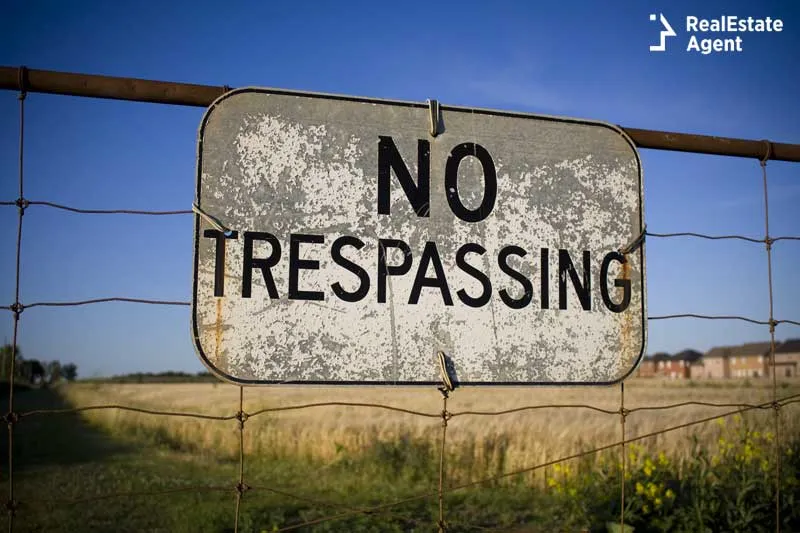
As a type of land survey requested by title companies and banks or lenders, a mortgage survey will show that there is no trespassing and that the property meets current zoning and building codes. Work with a licensed land surveyor for this instead of opting for a mortgage inspection which is not accepted as an official land survey. Mortgage surveys are very detailed - even the trees that are on the property are located, mapped and named. Also, in the case of a subdivision, the owner should keep the PUE (public utility easement) area clear and accessible, without buildings that are not supposed to be there. The measurements in a mortgage survey are usually within the allowable variance since each land surveyor will stand in a different place and will get slightly different numbers.
As a prospective buyer, you might also be tempted to rely on the Home Condition Report prepared by the seller. Be aware that it might be biased. So it’s better to rely only on third-party reports.
Sometimes mortgage surveys are referred to as title surveys since the same survey will be used by the title company. Some lenders might cover the cost of this survey. When a property was on the market for a long period of time, you could get the seller to pay for it, especially if you had no competition for the property. According to HomeAdvisor, a typical mortgage survey costs around $500. As you will see, mortgage surveys are way cheaper than the next ones.
 ALTA/ACSM Surveys
This type of land survey is usually used for commercial real estate. It is short for the American Land Title Association and the American Congress on Surveying and Mapping. An ALTA/ACSM survey reveals the existing improvements on a parcel relative to its boundaries as they appear in the property’s deed, as well as improvements, easements, rights-of-way. Since it covers all the features and characteristics of a property, this land survey is one of the most comprehensive. The cost is significant: from $2,000 up to several hundred thousand dollars. And it takes between two weeks and a few months to be completed.
Besides the property boundaries, here is what an ALTA/ACSM survey reports:
- Easement and second mortgages
- Use by other parties
- Encroachments
- Land improvements
- Zoning classification
- Roads and property features
- Access and routes to the property
- Waterfronts
- Flood zone classification
- Nearby cemeteries
 Boundary Surveys
Whenever you see a vacant land for sale online, you’ll probably see an image with a red line that clearly delineates its boundaries. In this way, you can easily identify it, especially if you’re given a satellite view of the area. “How is that possible? Is that image reliable?”, you may ask. Yes! The corners and the boundary lines of the parcel have been established through a boundary survey.
Knowing the boundaries is extremely helpful when building a fence between you and your neighbors. Or, if you have a remote rental property like a log cabin in a forest with a lot of wildlife around, building a fence will keep it safer. For example, we had a friend who was raising ducks in the woods, and he discovered that a fox was killing his livestock. So, he used the boundary survey to identify the fence line and which trees needed to be removed in the process. He found an iron bar stuck in the ground with flagging tape/surveyor tape that served as his benchmark. He even went one foot in, to protect himself against any contentions in the future regarding the property’s boundary.
How much does a boundary survey costs? Expect to pay survey crews between $175 and $250 per hour for a boundary survey. A quarter acre lot is surveyed in approximately 2-4 hours while a 3-acre lot takes up to 8 hours. On older properties or if there are no survey monuments in place a boundary survey will take a lot more time. Rich vegetation and a wooded lot will slow down surveyors, especially in rural areas, where lots are usually larger. Nevertheless, the next type of land surveys is equally important.
Construction Surveys
Surveying is a key part of any construction project. A construction survey guides the placement of new roads or buildings. During the construction phase, surveyors have a significant contribution and their presence might be required on the site from time to time. A construction survey is also known as a site layout survey. By accurately staking out the proposed location of structures (walls and corners) the contractor ensures that the project sticks to the plans and will be completed on time and within the budget.
A plot plan is universally used to place the property correctly on the ground by following a simplified foundation footprint and measuring the distance from the building to the property lines. All underground utilities are also installed at the beginning. A construction survey is not covering only the horizontal development of the building but also the vertical construction and ensures that piping works and surfaces drain appropriately.
An important phase is the rough grading staking when the ground is prepared for different elements like park lots, slopes and roadways. If the house is designed to have an above-grade basement, in this phase contractors make sure that the entrance will be above the ground, as this aspect will have an impact on the home’s market price later. A surveyor will also make sure that the building complies with the ADA accessibility requirements. As we have written in another article, there is a need for more houses designed for people with special needs.
During a construction project, As-Built Surveys might be conducted a few times for local and state boards to prove that the authorized work rigorously follows the specifications set on the plot plan.
Did you know that a construction survey could be necessary following a subdivision survey?
 Subdivision surveys
If you ever get into real estate investing either alone, or with friends and family, the idea of buying vacant land and turning it into a nice neighborhood or gated community might appeal to you. Such projects require a subdivision survey. This procedure is also known as subdivision platting. The splitting of the larger piece of land into smaller subdivisions results in a map of the new parcels that will make selling each individual parcel much easier.
Short plats (up to 4 parcels) are usually under less strict rules and regulations and the local Register of Deeds office might not require a subdivision map to be filed. After a subdivision survey is completed, the landlord will build houses with a similar look, either in a contemporary or traditional style, which makes these developments charming and very appealing to millennials who are just starting a family. Subdivision plats may include new roads that will ensure each future homeowner will have access to his/her property without trespassing someone else’s property. Complying with local zoning regulations could add more requirements such as a park, or easements for public utilities. The developer should not start building before an urban planning commission or zoning board has reviewed and approved the plat map.
A lot split might also be needed if an inherited land must be divided (equally or not) between heirs to satisfy a will or during probate or if the owner wants to build a second home or a commercial property that could be zoned for commercial use.
The average cost to split a piece of land in two is between $500 and $1,500 and up to $40,000 if you want to make more than two parcels. Prices vary from state to state. The subdivision survey could also take up to a year. So, in certain geographic areas, dividing a small land might not be worth it and real estate investors could benefit more from economies of scale once they split the land into 10 or more parcels.
 Topographic Surveys
Topographic surveys have been around since 1892. To locate both natural elements and man-made structures such as fences, utilities, elevations, trees, and streams, as well as any kind of improvements on a parcel of land you will have to undergo a topographic survey. Topographic surveys are great at analyzing the elevation of the ground. Usually, construction near steep slopes is not recommended as landslides and erosion could put the residents in danger. In this case, foundations could cost more than a house built on a flat surface. So, even though a piece of land could look like a dream, it might pose serious challenges even to the most experienced builder.
Topographic surveys are conducted with the help of some modern land survey instruments such as the reflectorless laser distance measurement, prism reflectors and total stations which are extremely sophisticated and require a lot of knowledge. A combination of aerial photography and ground field methods gives the best results.
You will need a topographic survey if you want to add a new building on your land. This land survey will reveal how your property will look after the addition of the new structure. A topographic survey will also tell if any leveling is required before building on a parcel. So architects use them a lot in order to efficiently plot the surface and visualize their work three-dimensionally. No other tool helps real estate developers and architects get a better understanding of the layout of the land. With this in mind, they can decide if their project is feasible or not. Topographic surveys reveal how realistic a real estate project really is.
In case you didn’t know, topography made its way in classrooms! Topobox is a box with sand that allows students to better understand and visualize landforms. The light from a projector colors the sand from blue to dark brown, depending on its height, generating a 3D map. This augmented reality sandbox is an excellent tool not only for geography teachers, but also for teachers of other sciences such as hydrology, topography, and geomorphology. For $6,890, Topobox is an entertaining technology in which any public or private school should invest.
Have you ever needed a topographic survey or one of the other types of land surveys? Do you have anything to add? If you’re not an active real estate investor, you don’t come across these land surveys too often. However, keep in mind that some land surveys could cost a lot and must be taken into account in any real estate development plan and even during a simple house acquisition.


Have a question or comment?
We're here to help.